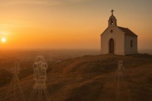
Climb St. Thomas Mount on a warm Chennai morning and the city spreads out like a restless sea—traffic murmuring below, the airport glinting in the distance, and the chapel at the summit basking in gentle light. It feels peaceful, almost too peaceful to have once been a scientific battleground. Yet two centuries ago, this hill was the first spark in one of the most ambitious scientific projects ever attempted: measuring the length and breadth of India with nothing but geometry, telescopes, and persistence that bordered on obsession.
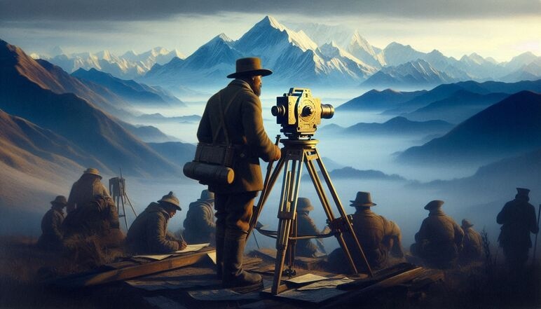
In the early 1800s, India was still a giant question mark for surveyors. Distances were estimated, boundaries debated, and even mountains were little more than myths. To bring order to this geographical uncertainty, the East India Company launched the Great Trigonometrical Survey of India. Its architect was William Lambton, a man who believed that the subcontinent could be mapped through triangulation—a method that uses trigonometry to calculate distances from a measured baseline and a series of precisely observed angles.
For a private guided tour of St Thomas Mount, please visit Following the footsteps of St Thomas.
For triangulation to work, Lambton needed a stable, elevated platform that overlooked the coastal plain. St. Thomas Mount, with its granite plateau and unhindered views, became his scientific stage. Field notes from the period describe massive theodolites hauled up the hill—some weighing over 500 kilograms—and carefully aligned on leveled platforms. From this summit, Lambton measured angles to distant signal points, stitching together the first triangular network of the survey.

Those early triangles formed the foundation of everything that followed. Every measurement was double-checked, sometimes repeated dozens of times, because atmospheric refraction—the bending of light in hot air—could distort readings. Lambton recorded these corrections meticulously, grounding his calculations in real physical science rather than assumptions. From this tiny hilltop, the network of triangles began creeping south, west, and north, like a geometric web spreading over the land.
But Lambton would not see the completion of his vision. When he died in 1823, leadership of the survey passed to a younger, fiercely rigorous officer: George Everest. Though Everest never surveyed from St. Thomas Mount—the work there was long finished—he inherited Lambton’s southern triangles and extended them across the subcontinent with almost monastic discipline. Everest redesigned instruments, refined observational methods, and argued passionately in scientific journals about the corrections needed for Earth’s curvature and gravitational anomalies. His northern expansions gave the survey the precision it needed as the network approached the Himalayas.

Here, a quiet but astonishing chain reaction unfolded.
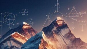
Using data from this enormous, decades-long triangulation, the Indian mathematician Radhanath Sikdar calculated the height of a distant Himalayan peak in 1852. It was known simply as Peak XV. Sikdar’s computation—done entirely through trigonometry and corrections for atmospheric conditions—revealed that Peak XV was the tallest mountain on Earth. His result was extraordinarily close to modern GPS values, a testament to the accuracy of measurements that began on a hill barely 300 feet tall.

Peak XV would later be named Mount Everest, recognizing the survey’s second superintendent—but the scientific lineage traces back directly to Lambton’s lonely instruments on St. Thomas Mount.
Standing on the hill today, it’s easy to miss the ghosts of that quiet drama. The granite platform where Lambton placed his theodolite is gone. The signal stations he observed have vanished into the city. Yet the coordinates fixed from this single vantage point still anchor India’s modern maps. A humble hill ignited a continental measurement, carried forward by two determined scientists and crowned by a brilliant mathematician who proved the heights of the Himalayas.
That’s the beauty of scientific history: enormous truths often begin in small, unremarkable places. St. Thomas Mount never grew any taller, but it helped India find its true size.
For a private guided tour of St Thomas Mount, please visit Following the footsteps of St Thomas.
Leave a Reply